雪山, which literally translates to “Snow Mountain”, is a mountain in Shei-Pa national park at about three hours drive from Taipei. It features Taiwan’s second highest peak at 3,886m, several hiking trails of varying difficulty, two cabins, and some shelters. The most popular and easiest trail to the peak starts at some 2,100m and goes up to the Main Peak at 3,886m in 10.9km. This main trail is easy and can be done by the average hiker in two to three days. Its trailhead is reached best by car. Public transport ends in Wuling, which is a 7km walk with 300m difference in altitude. Apart from the main trail, there are various more challenging trails. The famous Holy Ridge trail connects to the mountain’s North Peak and another one goes down westwards from the Main Peak.
On the main trail, there are two cabins for overnight stay, 七卡山莊 (Qika cabin) at around 2,400m and 三六九山莊 (369 cabin) at 3,100m. The cabins provide drinking water most of the year, bunk beds, and pit toilets.
The trails require a permit, for which to apply can be a somewhat tedious process for those who are not familiar with the system. Luckily enough, I have a very nice Taiwanese colleague with a passion for hiking, who did the paperwork for us.
While planning the hike, I talked to several Taiwanese people to gather information. Interestingly, all of them with only one exception (my colleague who organised the permit) adviced me to join a group or hire a guide. Their comments included “very difficult”, “very dangerous”, “you will get lost”. In the aftermath I am very happy that we did not join a group. I am not much of a group person and very much enjoy hiking quietly on my own (and my husband’s) rhythm.
My husband and I hiked 雪山 with three overnight stays as follows (all comments on difficulties and time estimates reflect the perspective of a somewhat experienced and somewhat acrophobic hiker of less than average fitness whose gear was carried by her husband most of the time).
七卡山莊 (Qika cabin)
We arrived at the Wuling visitor at around 4pm by public transport from Yilan. Not so keen on walking 7km along the street to reach the trailhead, we tried our luck hitching and were promptly picked up by a friendly Taiwanese. At the trailhead, we left our permit and were taken pictures by and with the ranger.
It took us a bit more than an hour to reach Qika. The trail was very easy with the steep parts perfectly covered with steps. Many hikers prefer to skip Qika, to sleep in a more comfortable place down in Wuling, and hike up to 369 directly, which I think is also a good choice. There are two rooms at Qika, one of which was occupied by a group of 40 students from Singapore and their guides and cooks (yes, the groups here even hire their own cooks!), and the other we shared with five or six other people. There is probably space for around 50 people per room.
Apart from sleeping, there is not much to do at Qika, so that was what we did.
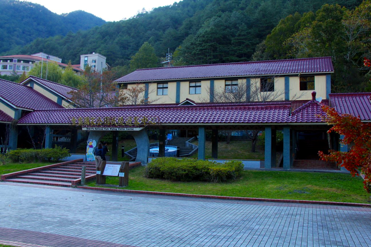
Wuling Visitor Center
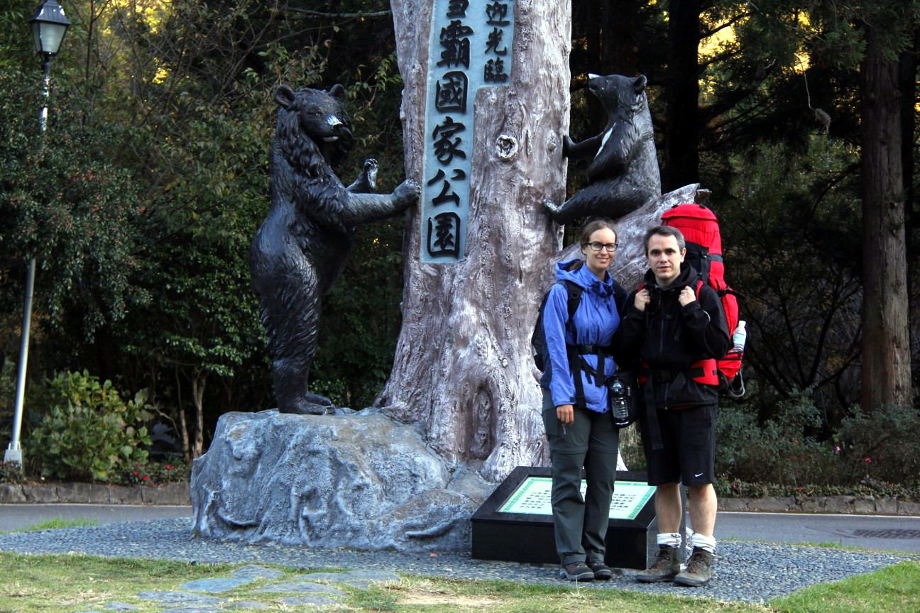
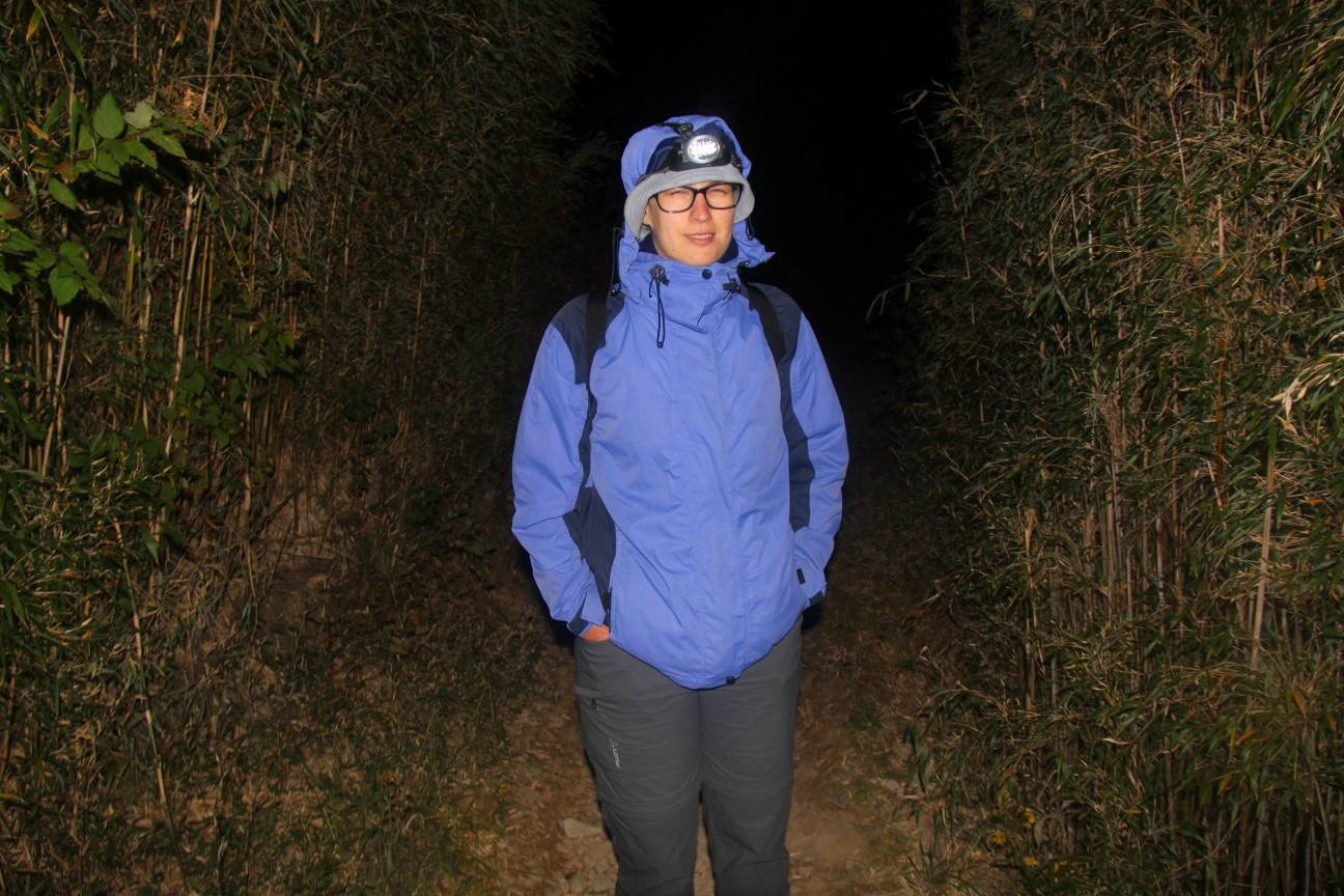
Ready to go!
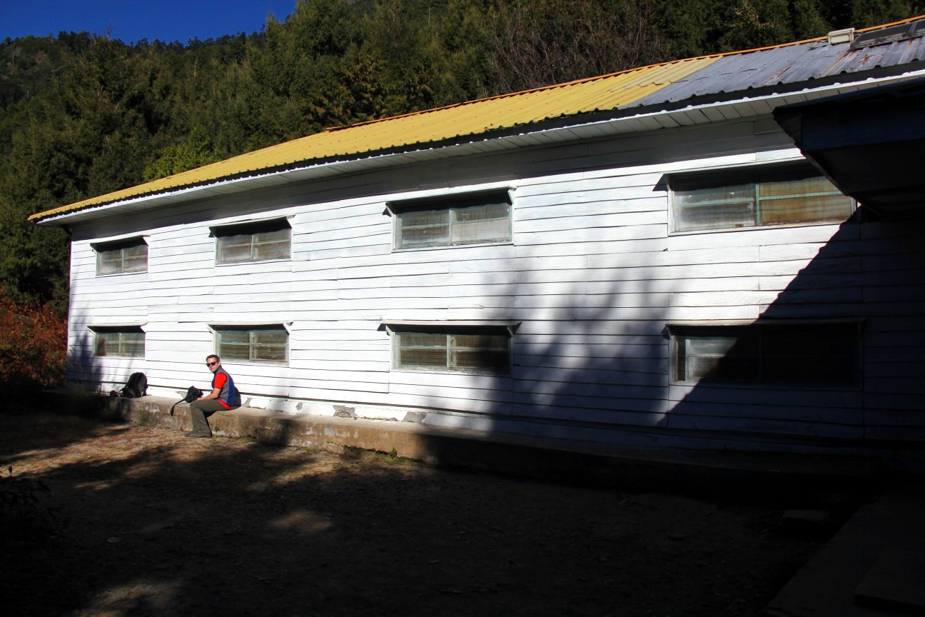
Qika cabin
On the second day, we hiked up to the 369 cabin. The cabin has its name from being located at the foot of a 3,690m peak. It took us about five hours to get there. The trail was easy and the scenery beautiful and diverse. The Crying Slope, a much-feared ascent according to various descriptions of the trail, turned out to be not difficult at all (not long, not steep, no need to use your hands).
Passing the Crying Slope, we reached a peak which we erroneously assumed to be the East Peak. We took some pictures, continued, and soon reached the real East Peak. We reached the 369 cabin soon afterwards. When we arrived, there were only a few other people. We were very lucky to spot (and even take a picture of) a Formosan Rock Macaque.
The cabin later became very crowded with the Singapore students and another, probably Japanese, group, and some smaller groups. The weather was gorgeous, but when the sun disappeared at about 4pm behind the mountain, the temperature dropped quickly to some 4°C. We hadn’t brought any cooking gear and were sipping some porridge in cold water when one of the group cooks, perhaps out of pity, offered us some hot soup, which we thankfully accepted.
We met the cooks on various occasions on the hike, as apart from preparing food for the groups, their duties also seem to include carrying gear between cabins and shelters, and maybe also maintaining the trails. They were very strong, friendly, and quiet indigenous Taiwanese.
We also befriended a very friendly guide and swimming teacher, who had two nicknames: “Mountain” in English and “木瓜” (Papaya) in Chinese. I really like the Chinese way of name-giving!
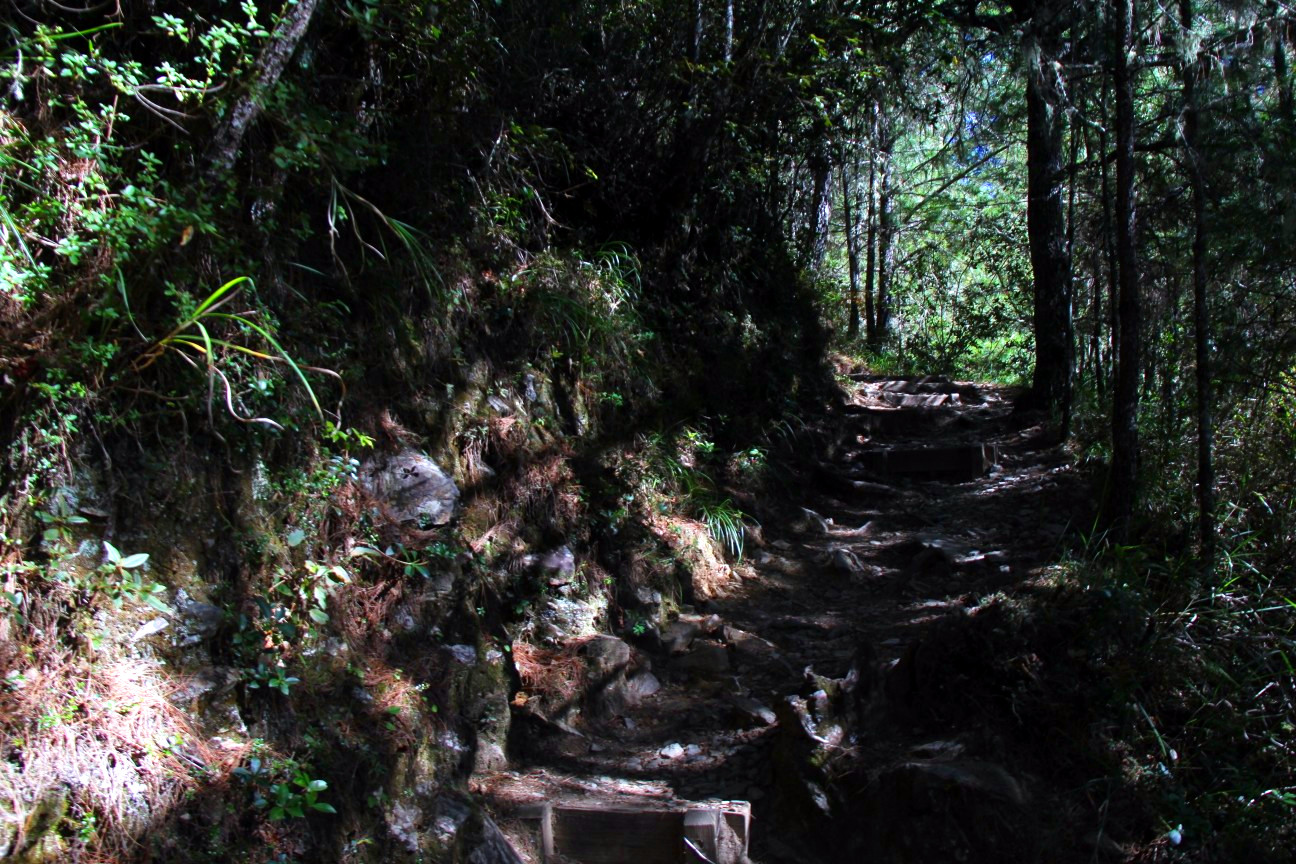
A comfortable trail to 369
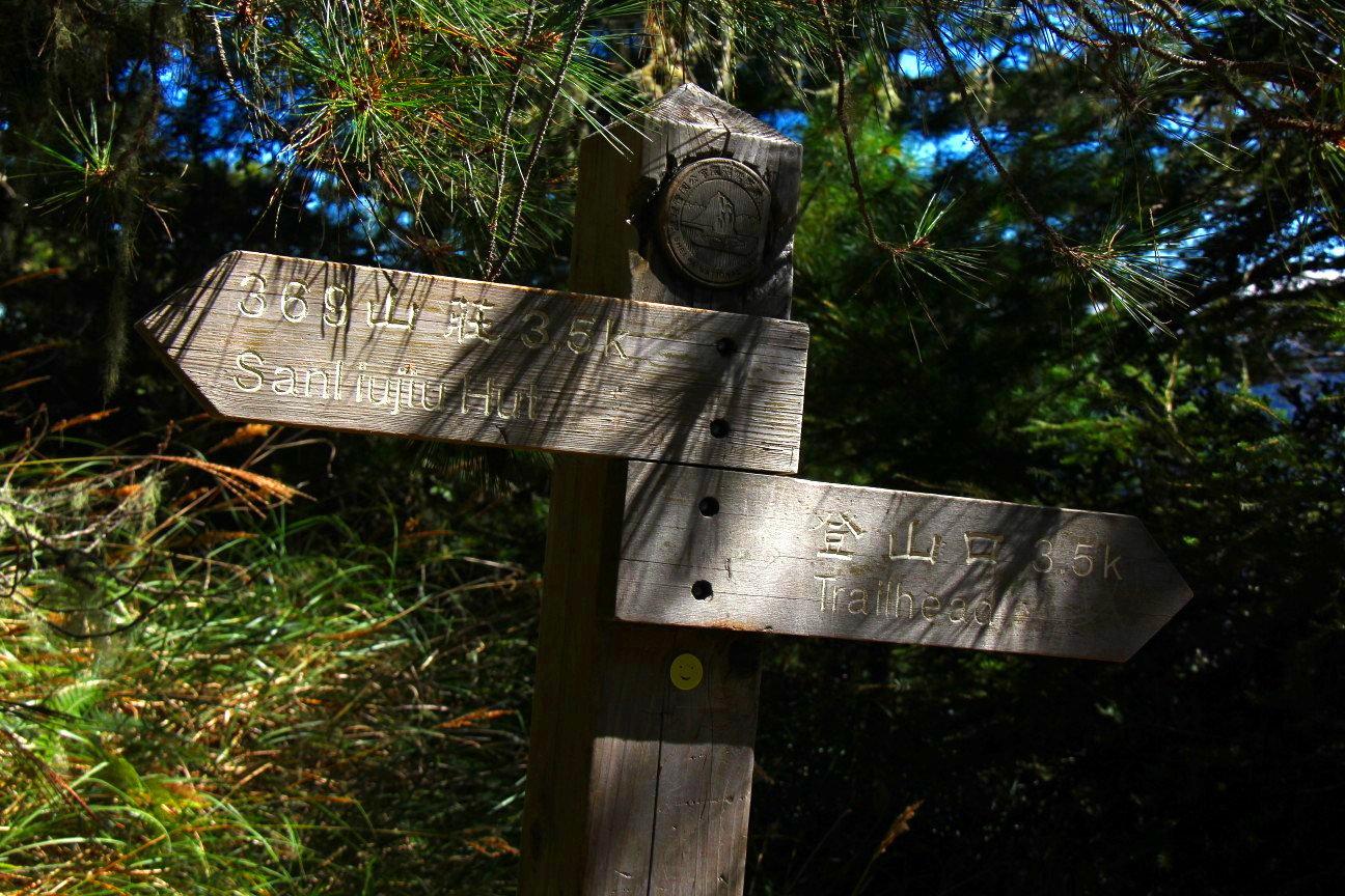
Directions are well indicated
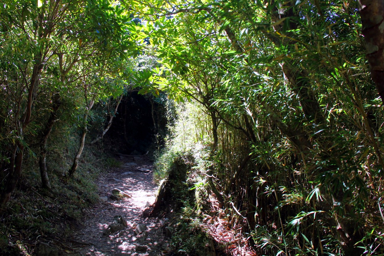
A bamboo forest
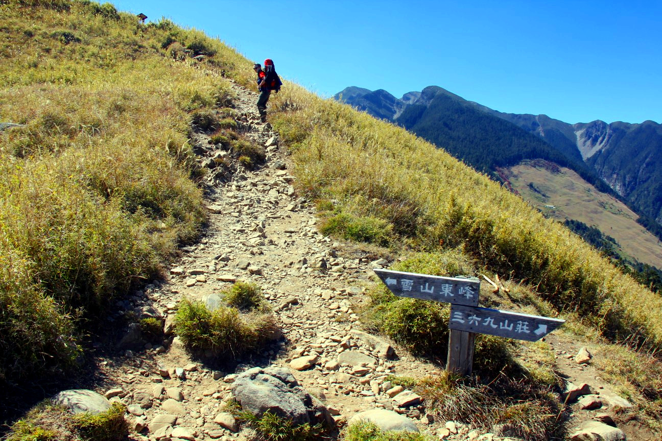
The trail to the east peak
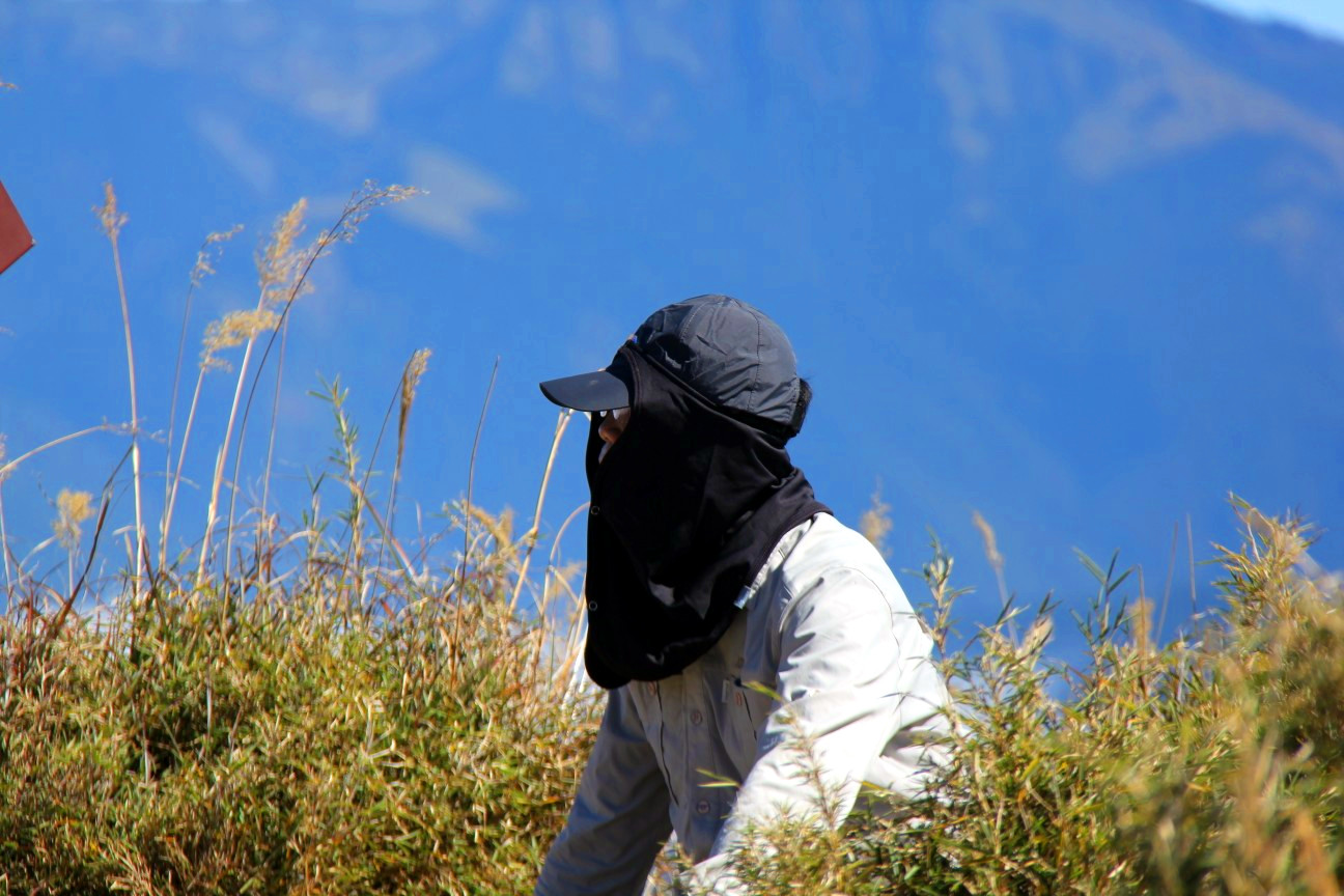
Taiwanese-style headcover, which we later found to be a very good idea
View from the east peak
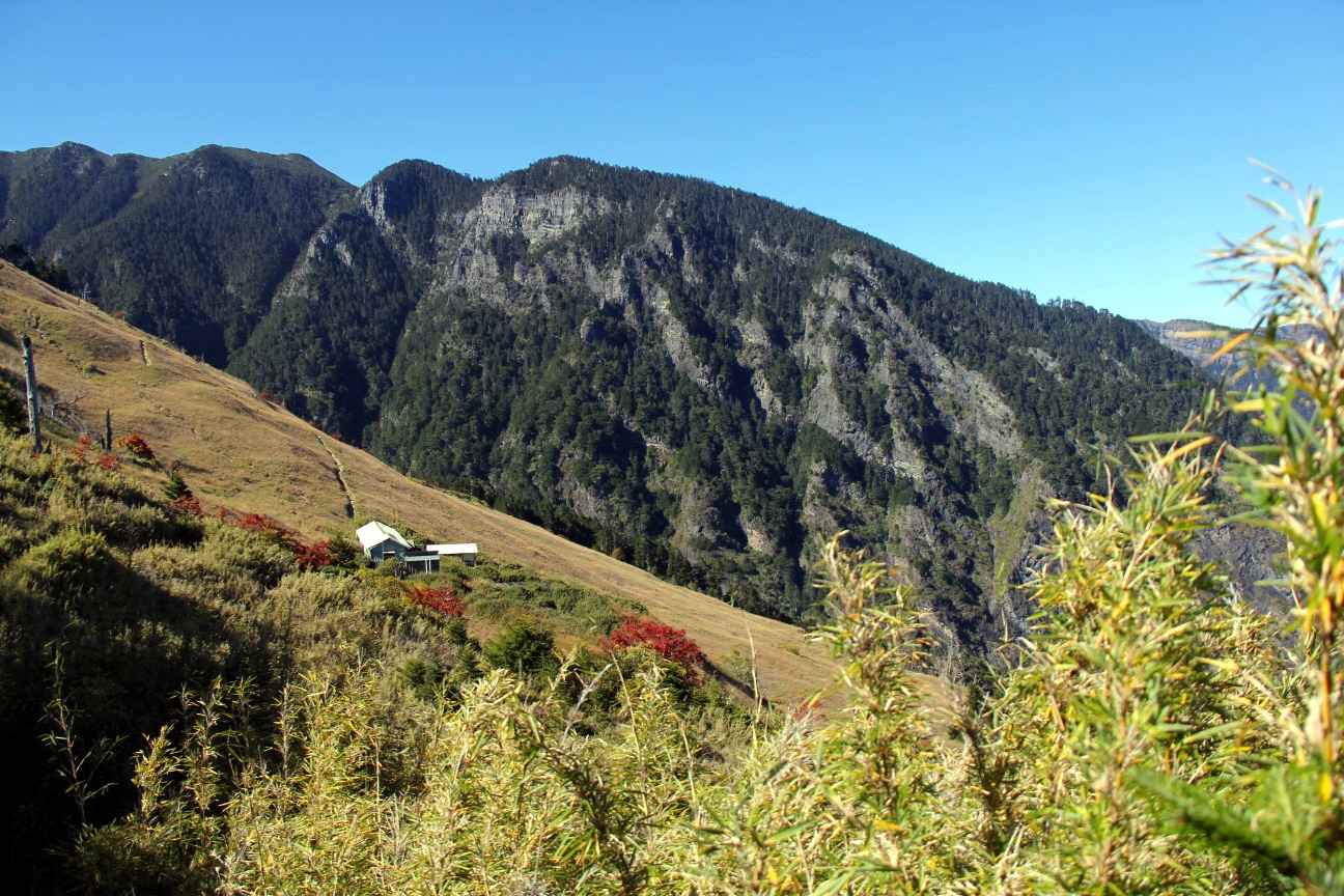
View on the 369 cabin
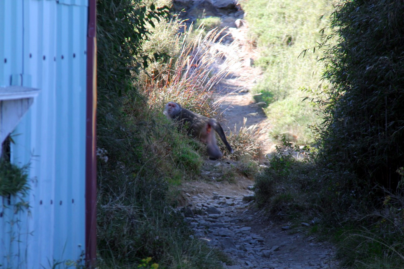
A monkey!
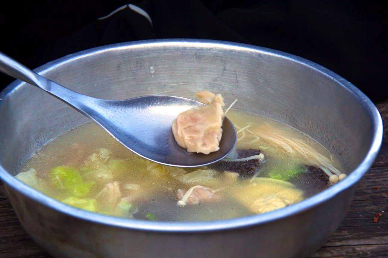
The soup
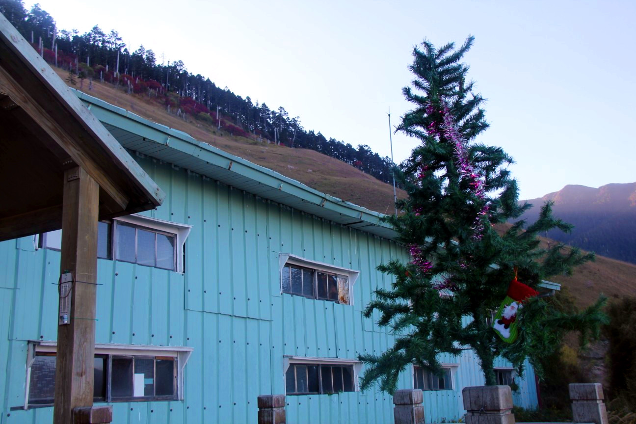
369 with a christmas tree
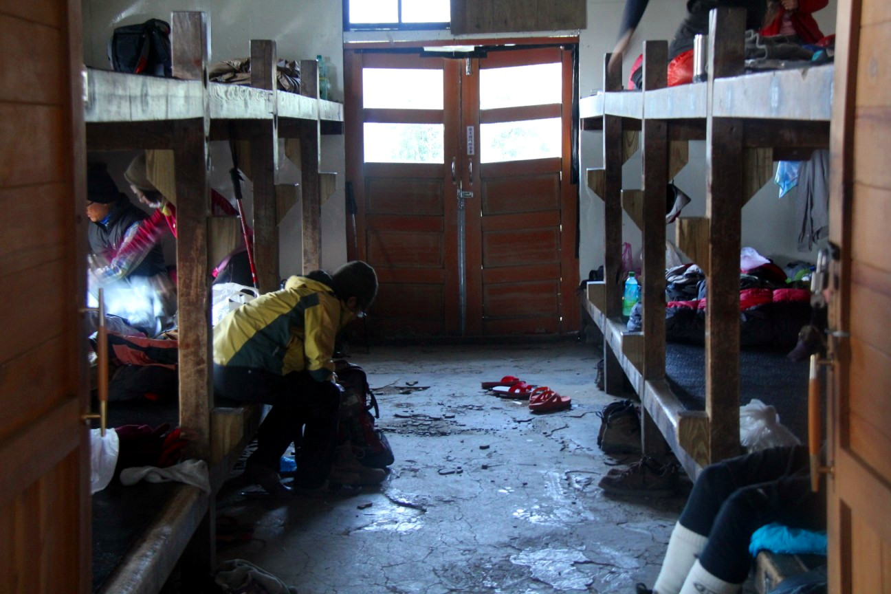
One room of the cabin. It filled up later with three persons between each of the wooden bunk columns
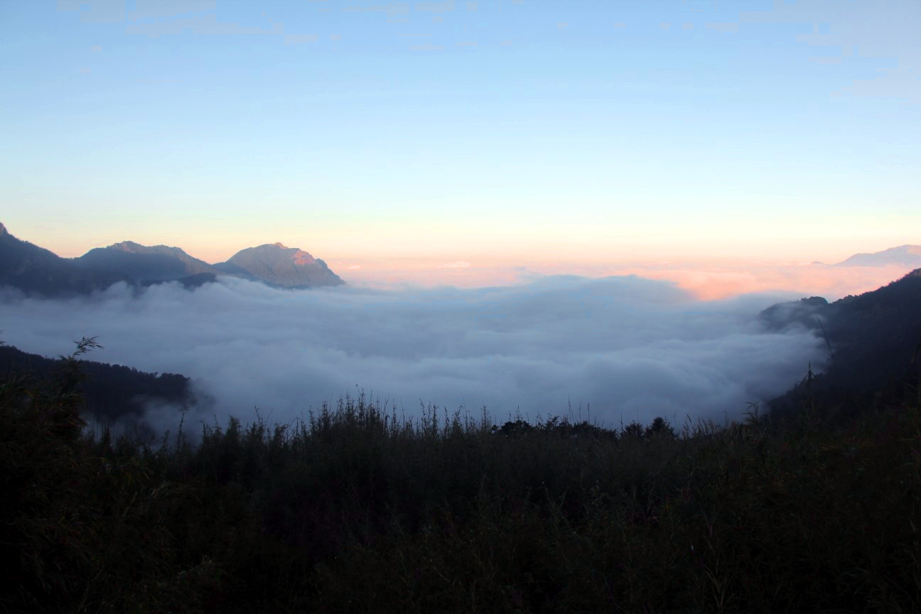
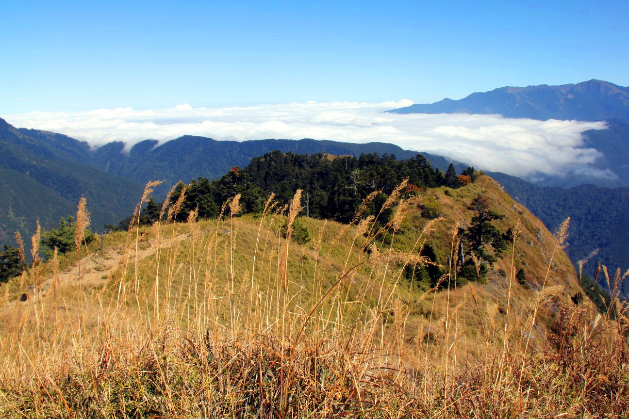
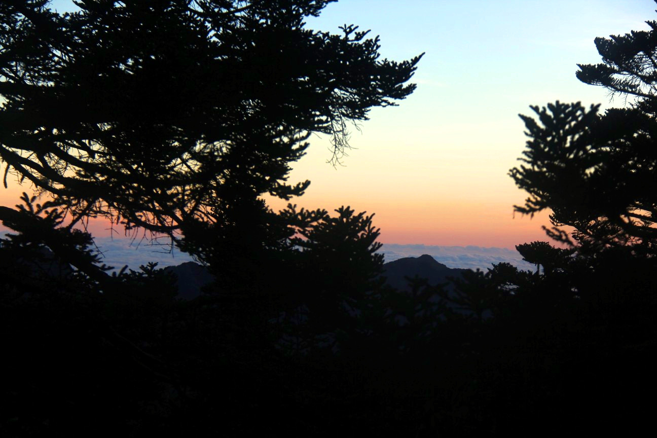
Dusk above a sea of clowds, view from 369
Roundtrip to the Main Peak and my first earthquake
The next day, we got up at 3:30am and, after arranging our luggage (which we could leave at the cabin), headed off at around 4:30am. There are two trails to reach the Main Peak from 369. One more direct and easy, which is usually taken by the groups, and one significantly more difficult, covering one end of the famous Holy Ridge.
We took the easy trail up to the Main Peak. After a short ascent on the hill behind the cabin, the trail goes up and down through a forest called “Black Forest” (It’s even more black if there is no daylight). I was a bit worried about waking some Formosan Black Bear, but luckily we didn’t. Approaching the peak, the increasing altitude started to manifest in breathing difficulties. It was not a big deal, but we walked considerably slower than on lower altitudes.
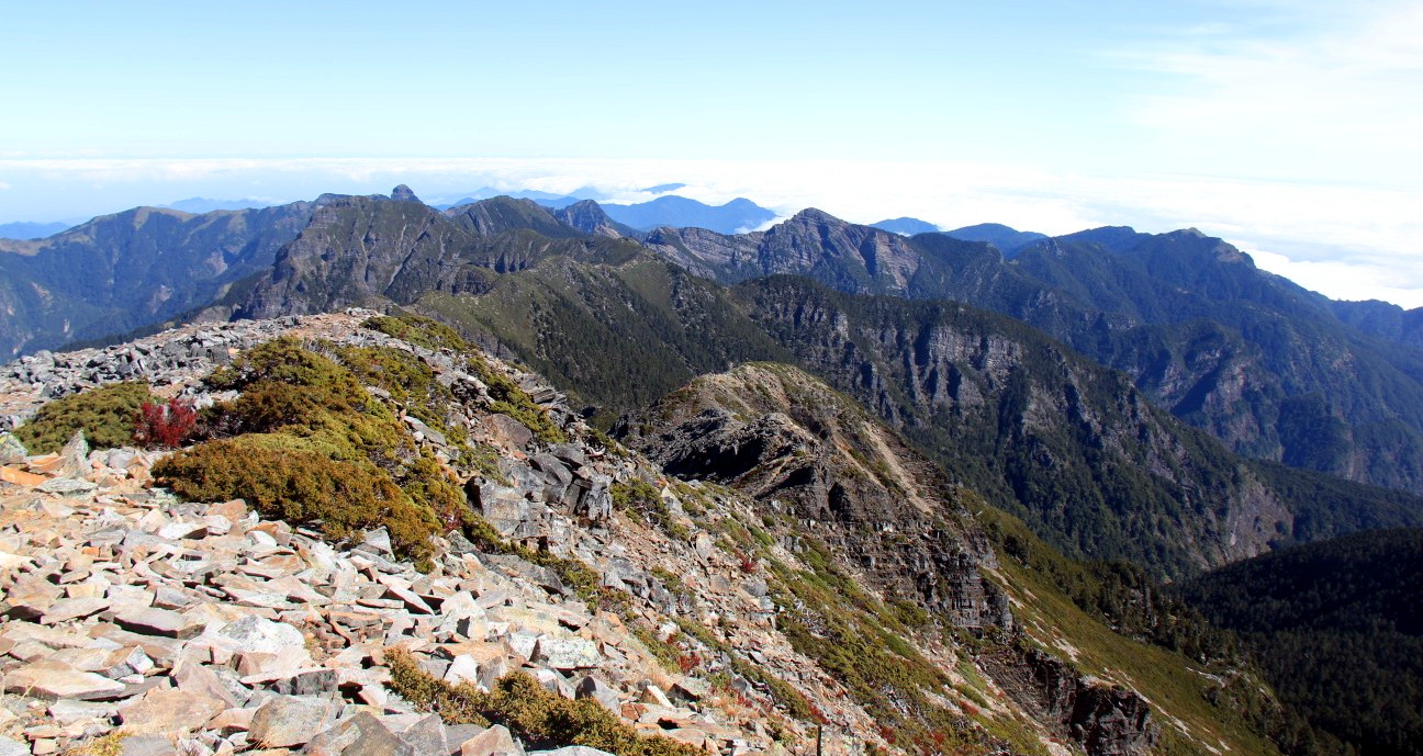
We reached the Main Peak at around 8am. Unfortunately, we missed the sunrise (which was at 6am), which surely would have added to the great view at the top of the mountain. But also well after sunrise, the views from the peak were breathtaking. The sky was clear and we could overlook a wide range of the Taiwanese mountains. Westwards we could even see the sea.
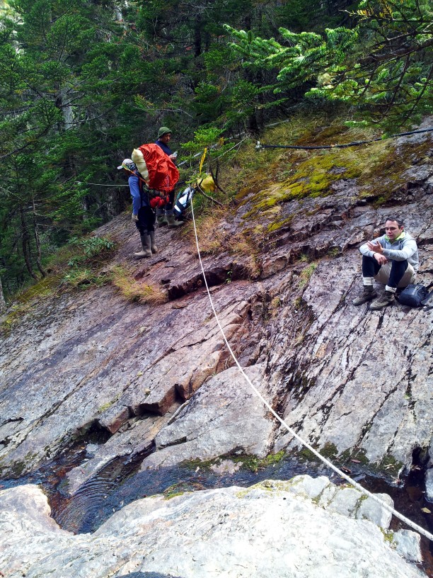
To get back to the cabin, we decided to take the route over the Holy Ridge. The trail so far had been easy except for the thin air, but this was going to change now (the difficulty, not the lack of oxygen). The Holy Ridge heads towards the North Peak of 雪山 over, well, a ridge. At kilometer 1.8, another trail turns eastwards connecting the Holy Ridge to the 369 cabin. In order to get to the Holy Ridge, the trail first descends from the Main Peak and then climbs up steeply. This climbing part was the hardest part for me because my acrophobia kicked in quite hard. It’s technically not extremely challenging (some might not even call it “climbing”) and there are ropes to hold onto, but the high inclination was giving me rushes of adrenaline.
The trail continues without major ascents or descents on the thin ridge (and my acrophobic adrenaline rushes continued, too). The views continue to be breathtaking. We met far less people on this trail than on the main trail, and among them, we came across the indigenous cooks twice. We were very impressed by them quietly and quickly walking the Holy Ridge in their rainboots(!) with probably more than 30kg on each of their backs.
At kilometer 1.8 we took the east turn towards 369. It starts off with a strongly inclined scree field, which was fun to slide down. After that, it continues for a subjectively very long time through the Black Forest until reaching 369.
We were quite exhausted when we reached 369 at around 14:30. The hike took us 10h including one long and several shorter breaks. We took a nap, ate, and took a nap again. In between, some hikers, guides, and cooks applauded my achievement upon asking which route we took. I think they did so because I am a woman (they did not applaude my husband), a foreigner, and because we were without guides, which seemed to impress them. I felt flattered nevertheless.
At around 20:00, we were woken up by a strong movement of the bunk beds. Until I realized that it was no just the beds, but the whole building was shaking, and that I was probably experiencing my first earthquake, it was already over. It had taken around 3 seconds only. I was very excited, my husband at least was surprised, but the Taiwanese people did not seem to care or even notice at all. We later learned that this was quite a heavy earthquake of magnitude 6.3. It was even covered by international media.
I spent the next hour or so thinking of worse places to be during an earthquake. I figured the pit toilet to be a very unpleasant location to be. Even worse, being outdoors below the Holy Ridge, I figured, would be very inconvenient, too. It’s not hard to imagine an earthquake causing rock falls. The permanent danger of earthquakes adds a significant risk to hiking in Taiwan which I previously hadn’t thought of. But then again, can it really be so dangerous if the locals don’t seem to care about it at all?
The cabin got busy again, though not quite as busy as the previous night. We slept little, with the last people arriving at 22:30 and the first leaving at 3:00, a high incidence of flatulencia and snoring, and my adrenaline deposits no quite yet emptied.
Tagwache! 4:30am
Dawn from the upper end of the Black Forest
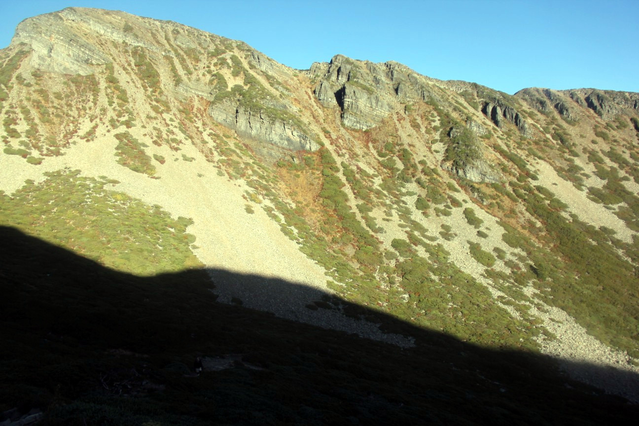
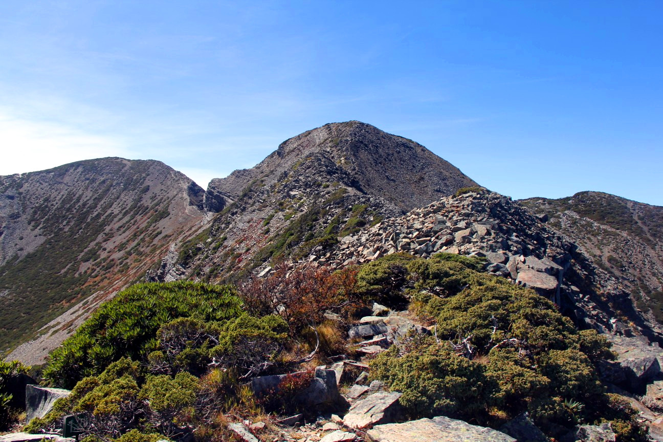
View to the Holy Ridge
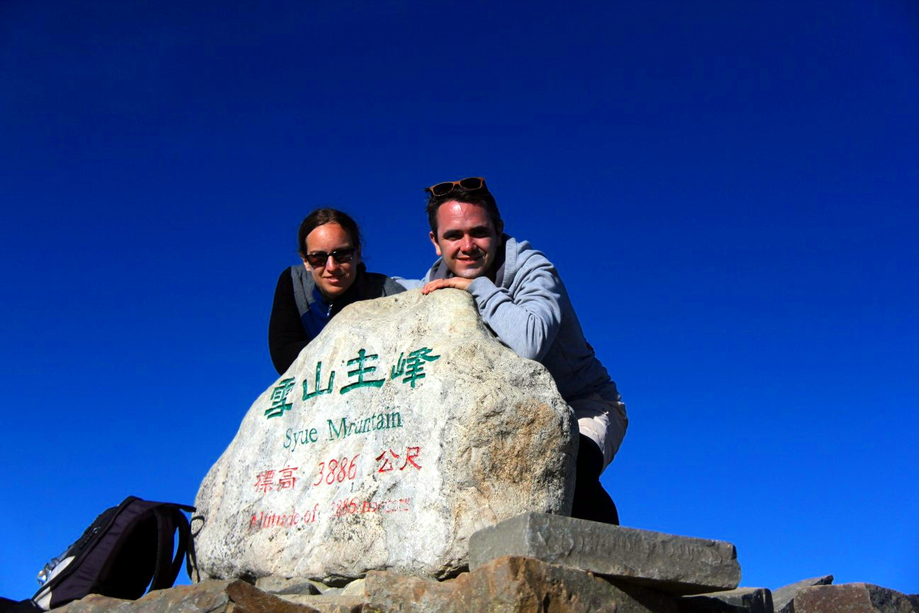
Gipfelsieg! The Main Peak at around 8:30am
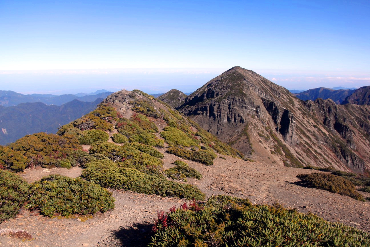
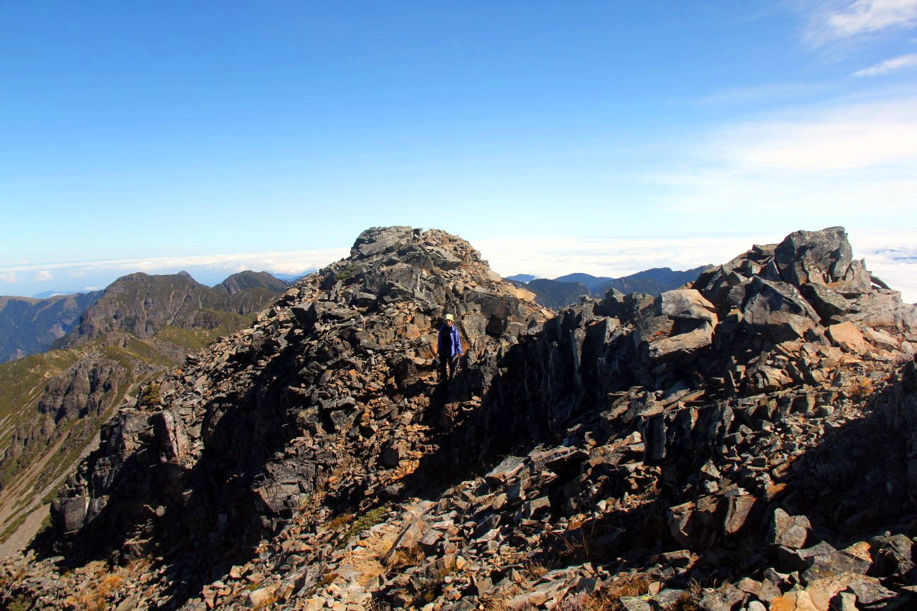
Walking towards the Holy Ridge
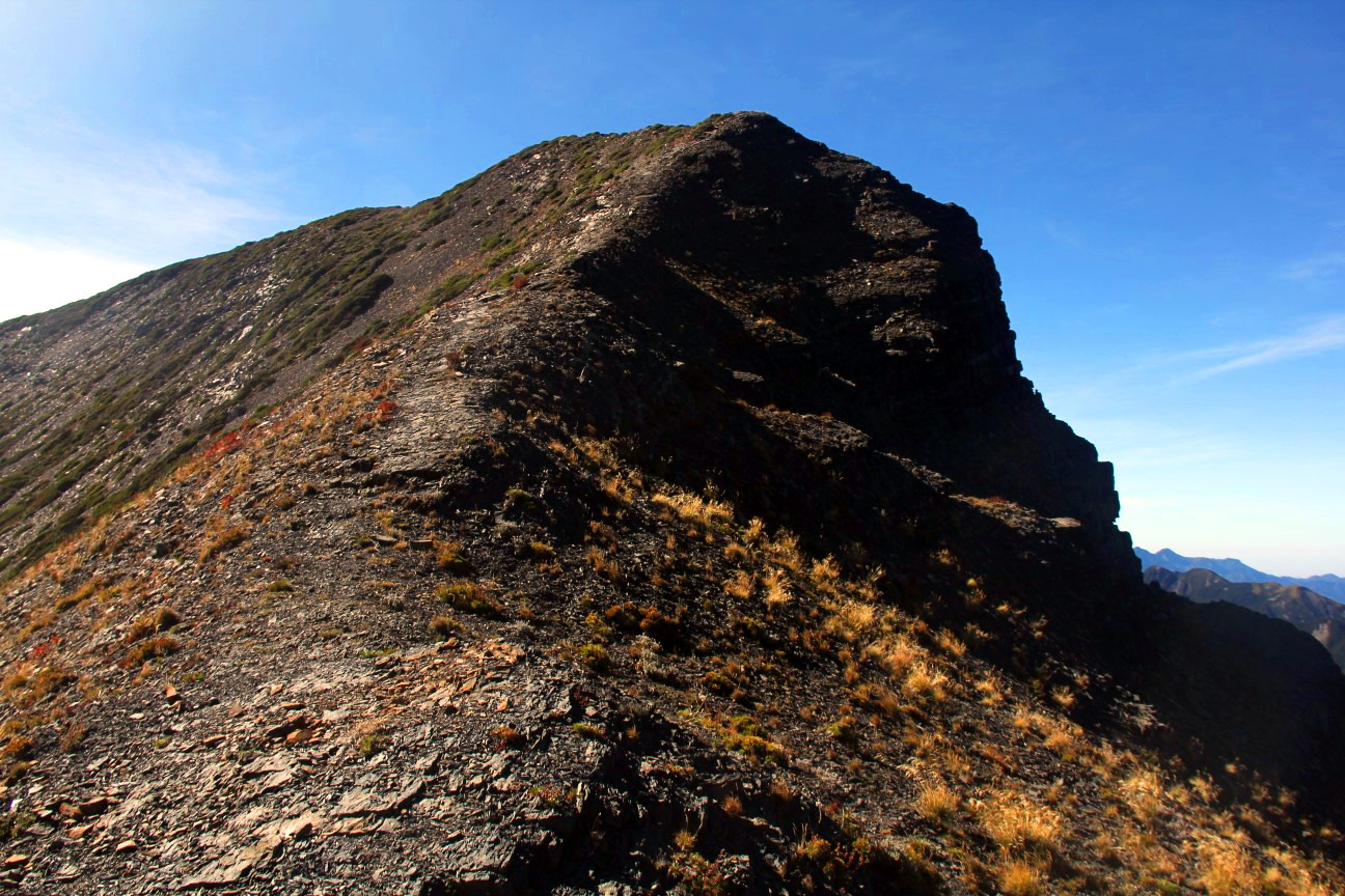
Connection between the Main Peak and the Holy Ridge, just as scary as it looks
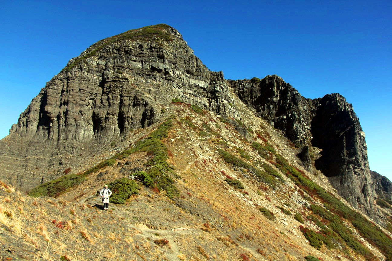
The trail up to the Holy Ridge. The climbing part goes up on the right side of the highest rock.
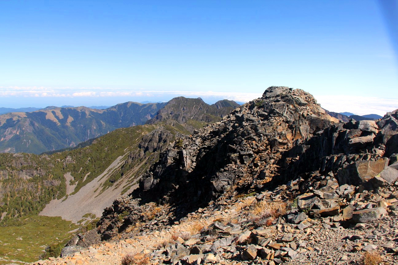
The Holy Ridge
Still the Holy Ridge
Still the Holy Ridge
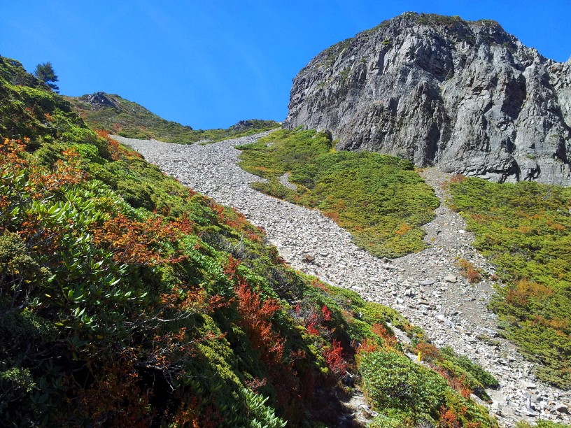
The scree field connecting the Holy Ridge to the Black Forest
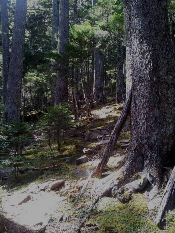
The Black Forest
The 369 water source, about 1km from 360. Second encounter with cooks in rainboots
Heading back to Taipei
We woke up (or were woken up) at 3:00 in a better condition than expected and after some unsuccessful attempts to go back to sleep, decided to start the descent. It took us some 5h, but I think it can be done in 3h. I walked very slowly because my knees were sore, and we took a long break at Qika. Also, this was our first and only rainy day.
Back at Qika, we also met some people whom we asked for the timetable of the bus returning to Yilan (there are only two buses a day). One of them kindly offered to take us back to Taipei. We first declined because we had to go to Yilan to pick up some of our luggage, but he insisted on taking us there too (it’s on the way). On the way, he also took up a British hitcher and we had a most wonderful 7-course lunch after three days of eating mainly almonds, cold porridge, apples, and bananas.
Tagwache, the 2nd
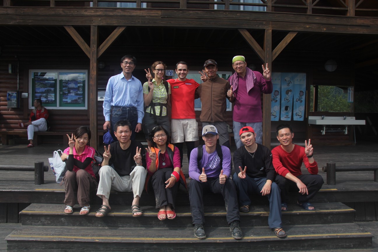
Group picture with the group we met at Qika
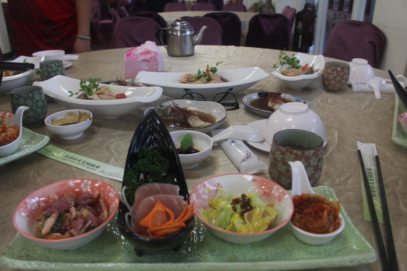
What a feast!
In summary, the main trail up 雪山 was a very rewarding, not too difficult hike. The detour to the Holy Ridge was a bit of a challenge, but this can be avoided by going back the main trail for those who are not up for it. However, despite the stressful moments up there, I do not regret a minute of it. It was a very unique experience with wonderful views and a good amount of exercise.

ganz toll, was du alles erlebst! Noch weiterhin schöne Tage!
Congratulation!